
We can provide these surveying services you desire. Please contact us to make an appointment!
Legal Lot
This type of survey locates the Property Pins (or if they are missing, re-establishes them) on the property. This is a Legal, accurate survey that will show measurements to the hundredth of a foot. It verifies Property Lines using the Original Plats, and against other surveys of record that may have been completed on the subject property. It does not include improvements.
One-Line
This type of survey is used to determine the location of one Property Line on a subject property. Generally used in fencing location, sprinkler location, or Property line disputes. It is a Legal, accurate survey that shows measurement to the hundredth of a foot
Legal Location
This type of survey combines the Mortgage Sketch and the Legal Lot. It is the most useful type of Residential Survey, in that it locates the Property Lines and all the Improvements (houses, buildings, driveways, landscaping, etc.), and is accurate to the hundredth of a foot. It can be used for Legally adding improvements, designing additions, locating fencing, etc.
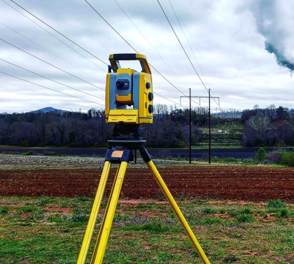
Construction Staking
This type of surveying consists of laying out buildings, foundations, or improvements on a piece of ground.
Subdivisions/Final Plats
Property owners who want to divide their land into lots for sale or development must go through a process by which the creation of any parcel of land 10 acres or less in the area is considered a subdivision, and subject to local regulation; and includes the requirements for subdividing land, also known as platting. Platting is a term derived from the approval process involving final plats. Final plats are the 'big picture' plans which show the proposed lot, block, and include the necessary utility easements, and public right-of-ways. The final plat is the instrument that once recorded with the Register of Deeds, grants the authority to the subdivider to start selling lots to prospective purchasers.
Elevation Certificates
This type of survey measures Elevation on a piece of property. It uses a known reference point, or benchmark, in which to compare the flood elevation of the subject property. Generally used for Flood Plain Information or Flood Insurance Requirements.
Letter of Map Amendments (LOMA's)
This document is prepared in conjunction with an Elevation Certificate and is submitted to the Federal Emergency Management Agency (FEMA) to exempt a Property (or improvements thereon) from the Flood Zone. This may remove the requirements lenders have for Flood Insurance.
Boundary Survey
Similar to a Legal Lot but used when surveying larger pieces of Property. (Larger than 1 acre)
Section Splits
This type of survey breaks down a large piece of ground into smaller ones. Usually done in rural areas when dividing off ground or subdividing it into smaller tracts of land.
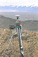
Tower Surveying
This is a specialized survey, usually requested by Cellular Telephone Companies that are locating and erecting Cell Tower Sites. It encompasses locating and staking the lease area, ingress/egress routes for utilities, locating, and measuring heights of the antennas to comply with FAA regulations.
2-C Letter (letter of Certification)
This type of survey locates the Tower to Latitude, Longitude, Elevation at the base, and height. (50' Lat. and Long. 20' Elevation)
1-A Letter (letter of Certification)
Same as 2-C, except tighter parameters. (3', Lat. and Long, and 20' Elevation)
ALTA's (American Land Title Association)
This type of survey is most often used in commercial buildings and is to a pre-defined set of standards dictated by the American Land Title Association. This is a very comprehensive survey, and locates virtually everything connected with the property, including but not limited to: Improvements, Concrete, Parking Stalls, Utilities, Curb cuts, Sewers, Storm Sewers, Easements, Zoning and Setback information, Adjacent Property Owners and Building Locations.
Topographic Survey
Topographic Surveys are used to identify and map the contours of the ground and existing features on the surface of the earth or slightly above or below the earth's surface (i.e. trees, buildings, streets, walkways, manholes, utility poles, retaining walls, etc.). If the purpose of the survey is to serve as a base map for the design of a residence or building of some type or design a road or driveway, it may be necessary to show perimeter boundary lines and the lines of easements on or crossing the property being surveyed, in order for a designer to accurately show zoning and other agency required setbacks.